Thursday, April 30, 2015

Pictures - Leaving Mountain Harbour
Hiker "Not A Bear" enjoying a Bob's Dairyland
Holy Cow burger.  Three half-pound beef patties, ham, bacon,
cheese, onion rings, chili.


Someone put a park bench out in the woods!

View from the park bench

Mountaineer Falls shelter

Mountaineer Falls

Elk River - where's a trout fly rod when you need one?

Meadow beside Elk River - camping anyone?

Jones Falls

Views like this you don't get from roads

Leaving Mountain Harbour

4/30/15 - Slackpacking again
Dave drove us out to Forest Service Road 293, at Mile 407.5, and we started hiking back to Mountain Harbour a bit after 9am.  The grade was easy and the trail in superb condition.  We passed Onward, Brokedown, Sam I Am, Dusty Pilgrim, Johnny Adventure, Happy, Zen, several section hikers and a bunch of thruhikers we don't know. They will all be about a half day ahead of us.

Mountain Falls shelter was built in part by Hikers Chuck Norris and his wife Tigger.  It's a great shelter, sleeps fourteen on three levels, has a solid metal roof and venting.  We passed it about lunchtime but pressed on southwards to Jones Falls.  Then on to the shelter before the rain started in earnest.

We reached the hostel a bit after 3pm; recording a pace of about 2.3mph.  Our trail legs are arriving.  Wilson called Bob's Dairyland and they sent a shuttle.  As we were finishing supper, the rain hit hard and the temps crashed.  Bob's drove us back to the hostel.  Tomorrow Dave will drive us to FS293 again and we will hike to Kincora hostel in Hampton,TN.

Pictures - Mountain Harbour hostel area

"Wilson" on Hump Mountain summit


Badly worn trail down from Hump Mountain

Back into Tennessee near Doll Flats

Barn at Mountain Harbour - the hiker hostel is in the
loft to the right of the porch

Pictures - Roan Mountain to Mountain Harbour Hostel

Looking west towards Roan Mountain from Grassy Ridge Bald

The broad two-leafed plants are ramps
Also called wild leeks (Allium tricoccum)
The air smelled of onion
Looking back to Overmountain shelter

View back from Little Hump Mountain
Roan Mountain is to extreme upper right

Looking forward from Little Hump to
Big Hump Bald

Looking back from Big Hump to little Hump
Roan Mountain is visible on far horizon, 9 miles away.

Mountain Harbour Hostel

4/28/15 - Mountain Harbour B&B and Hostel came and picked us up in Erwin this morning.  Dave drove us to Carver's Gap and carried our gear forward to the hostel.  Ms Cattywampus (Onward) and Brokedown were getting dropped off by Mountain Harbour as we arrived.  We slacked forward and got here just before 5pm.  We passed Sam I Am and Dusty Pilgrim a few miles in, not sure where they plan on stopping tonight.

We passed Sublime's pack at the turnoff to Overmountain Shelter but we didn't go down.  I heard later people had had norovirus and stayed there.
  
Coming down from Big Hump Bald we hit a bad patch of trail.  Serious rocks and lots of tangling roots.  It's marked for maintenance but they're gonna have to do a LOT to refurbish that mess!  Wilson rolled an ankle and I aggravated my foot and knee.

There's a hiker here at Mountain Harbour named Captain K who looks a lot like the actor John Malkovich.


4/29/15 - I woke up this morning with my right knee stiff and slightly throbbing.  Plus, I just don't feel like hiking today.  Wilson's lower leg and ankle are swollen and he's in pain.  So instead of slacking thirteen today, we'll do that tomorrow and be bored silly today during a zero. Of course, tomorrow has a better rain chance.  

Kinder, who we met yesterday, drove several of us to Roan Mountain for lunch at Bob's Dairyland restaurant. Food there is good, plentiful and cheap.  Bob's is also one of the few local hiker friendly stores.

Pictures - Erwin to Roan Mountain

"Sarge" from Uncle Johnny's hostel

View NW from Little Rock Knob - Roan Mountain

Eastern Red-spotted Newt


Rhododendron 

Hiker "Johnny Adventure"

Usually there's a nice view at Beauty Rest

Spruce stand on Unaka Mountain
Photo exposed close to natural light level

Slackpacking out of Erwin

4/26/15 - Slackpack Day One
Sarge from Uncle Johnny's picked us up at the hotel and dropped us off at 8am at Iron Mountain Gap, twenty miles north on the trail.  We slack packed back to Uncle Johnny's and arrived about 5pm.  It was a dreary day weather wise, in the sixties and we spent most of the day in the clouds with occasional drizzle. We hiked all day in rain gear.

We made good time, arriving at the spruce stand on Unaka Mountain before eleven.  We also got to see a fair number of friends who we thought were further ahead than they actually are.  Sam I Am and Dusty Pilgrim, Johnny Adventure, Ms Cattywampus (who now goes by the name Onward 'cause she just won't stop), Broke Down, and Trixie and her dog Gertrude.  Happy left out of Erwin today, as did Sublime and Chipmunk.

Anchor has been fouled and is off trail, hopefully not for long, with a banged up knee.  Coed called late last night needing medical help.  He was near Sam's Gap, about a day and a half from Erwin, alone in his tent on a night with bad thunderstorms, vomiting from a stomach bug.  Unfortunately, all the shuttles had closed for the night so he had to tough it out.  He made it to town today, but will be sidelined a few days to recover.  Injuries are almost unavoidable out here.  Wilson rolled an ankle today but is still going.  My right knee is still bothering me with minor tendinitis.


4/27/15 - Slackpack Second Day
Sarge drove us up to Carvers Gap below Roan Mountain and dropped us off.  He about gave me heart failure when he remarked that it was 24 miles to Iron Mountain Gap. My maps and the guidebook show the distance as 16 miles.  He left with a long 'Okayyy' that implied disbelief.

We made Iron Mountain Gap by 4pm.  Sixteen miles in 7 hours.  We met Poppa Bear and his son HB, they are going north on a section hike.  

Roan Mountain is now a state park with extensive rhododendron patches.  There is a yearly festival.  The Appalachian Trail crosses the summit of Roan Mountain, Carvers Gap, and Jane Bald, which is on the opposite side of Carvers Gap from Roan Mountain.  

Zero Day in Erwin

4/25/15 - Zero Day in Erwin

While Wilson was holed up in the hotel today with his class work, I went over to Uncle Johnny's to arrange the next three days hiking.  In the end, Uncle Johnny will slack us backwards to Erwin two days, Sunday and Monday, and our next hostel, Mountain Harbour B&B and Hostel in Roan Mountain, TN, will pick us up in Erwin on Tuesday, drop us at Carvers Gap and carry our gear to the hostel while we hike forward.  It's no different in mileage, but will allow us to try a different style of hiking.

I've had a few questions about some of the jargon we use out here on the Trail, so I'll try and address those.  

The Appalachian Trail is over 2000 miles from end to end.  The exact mileage changes yearly as trail maintenance causes reroutes. Thruhikers attempt to finish the entire trail in one attempt,  section hikers complete portions of the trail as time permits, finishing the trail over the course of years. The Appalachian Trail Conservancy (ATC) governs the trail, and they do not officially recognize either designation.  Hikers are asked to honestly answer the question "Have you walked the entire trail?" in order to eligible for the 2000 mile patch and listing in the magazine.

Slack packing is an alternative method of backpacking.  It can be performed in any direction, northwards or southwards on the Trail. The hiker deposits most of their gear at a safe location such as a hostel, and is driven to a road crossing a certain distance from the hostel.  They then walk to the hostel and their gear.  Generally they will carry water, lunch, a camera and rain gear. So the pack is 'slack' instead of fully loaded.  Often, they will use a borrowed daypack instead of their personal full sized pack.  The ATC doesn't care about how much a hiker carries.

Stealth camping is camping in unofficial places on the trail instead of at prebuilt campsites or shelters.  While allowed in most places on the AT (except national parks and certain states in New England), it is becoming discouraged due to the increasing damage to the land from the increasing number of hikers each year.

The Trail is marked on the official route with white rectangles 2x6 inches.  Intersecting trails, bad weather bypasses, or side trail are marked with blue blazes.  It is sometimes possible to shave total miles from the official route or avoid elevation changes by following blue blazed trails, hence the term blue-blazing.  This is frowned on.  Roads are marked in yellow "blazes" 6 inches wide by 10 feet long. Taking a ride to bypass unwanted trail is called "yellow blazing" and is prohibited.  A hiker can get a ride to town and back but the ride has to drop off where it picked up.  Aqua blazing is when a hiker uses water transport to bypass certain trail sections.  This is prohibited by the ATC as it is not hiking.  "Pink blazing" is performed when a (usually male) hiker attempts to make a physical liaison with another hiker or a local.  Pink blazing does not usually affect trail mileage, unless it somehow involves yellow blazing.

Friday, April 24, 2015

Pictures: Hot Springs to Erwin

One last look at Hot Springs, NC

This spring is about 18 inches across and 3 inches deep
But good cold water.

Doesn't it sound delicious?

Trail going up Big Firescald Knob

Gets you a view like this to the NW towards Greeneville, TN


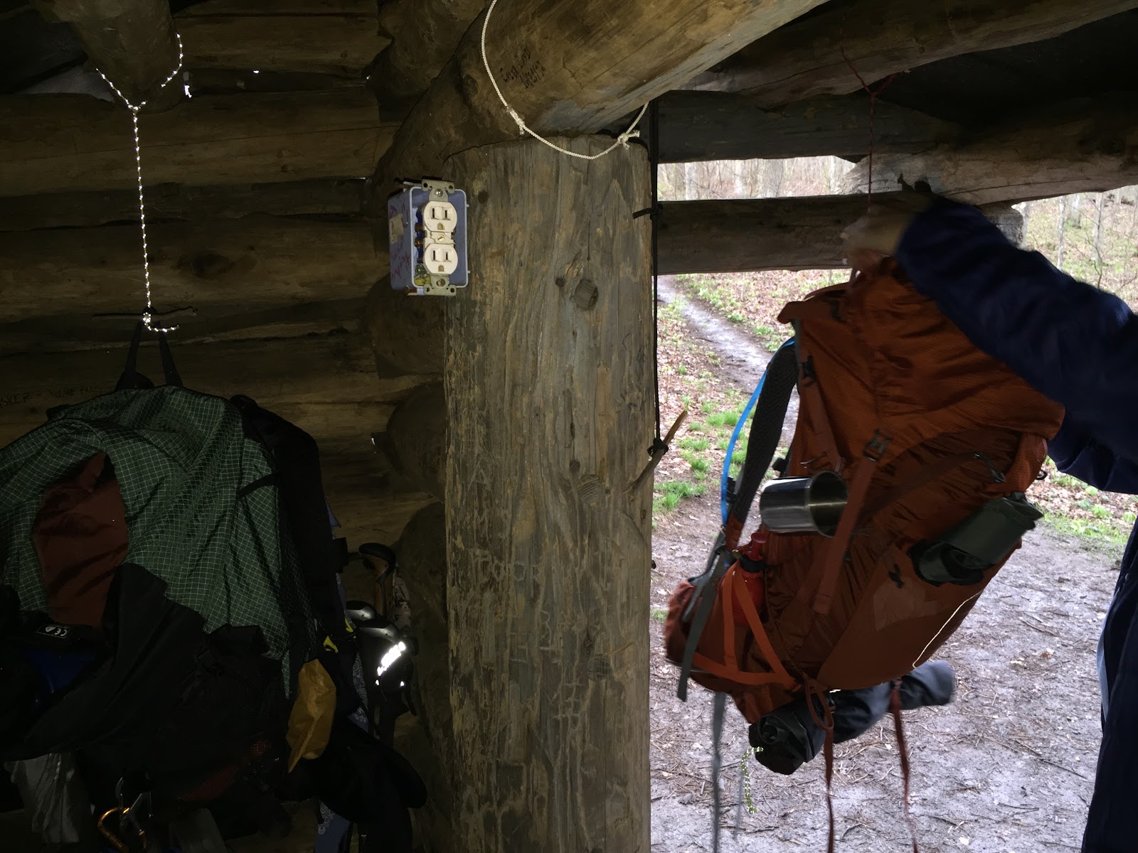
Finally, a shelter with electricity!
(Maintainers have twisted minds)


I count three white blazes, how many can you find?
Yes, that's the trail.

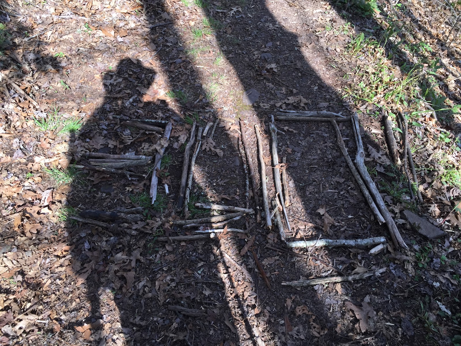
300 miles

Going up Bald Ridge

Trail Angels- they all have done the trail previously 

Dorothy Hensley
May 2, 1865
April 30, 1965

Cascade the trail repeatedly crosses
On a hot day the water is so nice!

White trillium

Red trillium


Mayapple carpet


On top of Big Bald
Temp about 50, wind 35mph gusting to over 40

Hiker "Wilson" on Big Bald

Looking up the trail

See the hikers?


First glimpse of Erwin, TN


View of the Nolichucky River and the CSX rail bridge 

In front of Uncle Johnny's Hostel
www.unclejohnnys.net

1822 miles to Katahdin